In Switzerland, there are areas where flying drones is prohibited or only possible to a limited extent. As a drone pilot, you are required to learn about applicable area restrictions before each drone flight.
NOTAM / DABS
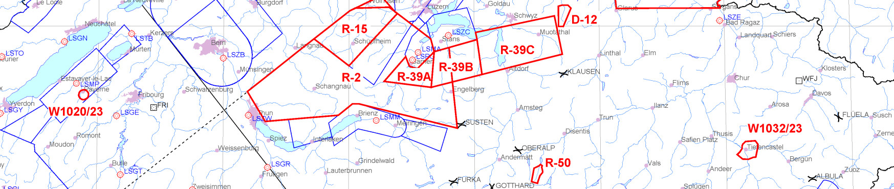
NOTAM (Notice to Airmen) is a notification containing information about the establishment, condition or change of any relevant component (facility, service, procedure or danger) of the airspace. This may also impact drone operations, therefore a UAS operator must check the NOTAM before every flight.
Most NOTAMs concerning navigation warnings and airspace changes (W series) are shown graphically (red zone) in the Daily Airspace Bulletin Switzerland (DABS). The map and the NOTAM text section are updated daily at 4pm for the following day.
National and cantonal restrictions
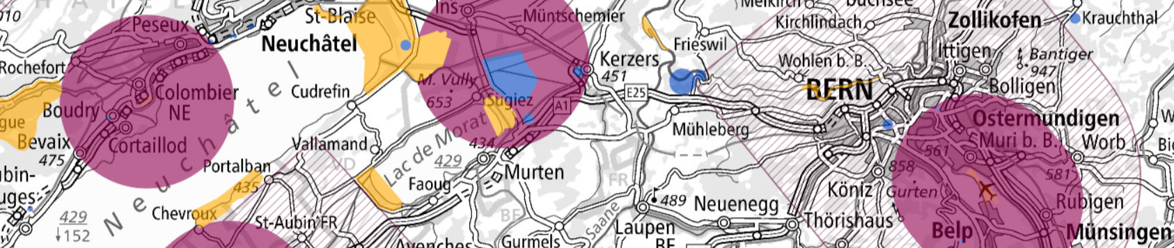
The content of the interactive drone map is always changing and is also not exhaustive. The drone map shows the national and cantonal area restrictions. These include:
- 5km radius around civil or military airfields
- Control zones CTR
- Civil airfield perimeter according to the sectoral plan for aviation infrastructure or military airfield perimeter according to the sectoral plan for the military
- Penal institutions
- Certain protected areas
- In the vicinity of nuclear power plants
- Over military zones
- Certain energy and gas supply infrastructure
If you are unable to comply with the additional flight restrictions, you must contact the responsible authority to apply for authorization. The contact details of the competent authority and the conditions for flying in a given geographical area are specified directly on the map (‘Object Information’).
Beware of hot spots!
In order to prevent an ‘airprox’or even a collision with another airspace user, drone pilots need to take particular care and precautions when operating in the vicinity of:
- Hospitals and other health care facilities with helipads: Map
- Mountain landing sites: Info (DE) & Map
- Hazard zones of Swiss Armed Forces' shooting ranges: Map
- High activity areas for gliding, paragliding and hang gliding: Glider Chart & Flying areas SHV
Further information
Last modification 07.06.2024